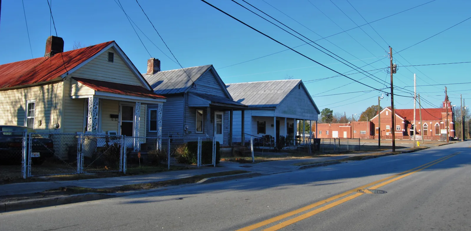
Bethlehem, south of Laney Walker, is zoned for Lucy C. Laney High; two-thirds of it is a National Register district. ZIP 30901: $72,068 in August 2026.
Last checked Oct. 6, 2026. Sources: Augusta’s GIS neighborhoods layer and National Register districts layer, the city’s 2023 comprehensive plan, the Richmond County School System’s School Zone and Bus Stop Locator, the state’s 2025 School Grades data, Zillow Research, Augusta Transit’s route data and OpenStreetMap.
Bethlehem is a neighborhood of older houses, churches and corner businesses south of downtown Augusta, just south of Laney Walker. The city’s 2023 comprehensive plan lists Bethlehem among the neighborhoods whose historic resources were surveyed and listed on the National Register, and among the three districts, with Downtown and Olde Town, for which federal preservation grants paid for design guidelines. The city’s neighborhood map draws it at about 0.65 square miles.
What this means for you
- Zoned high school: Lucy C. Laney High, for the whole neighborhood. Check one address in the district’s zone locator.
- Home value: $72,068 in ZIP 30901 in August 2026, according to the Zillow Home Value Index.
- Nearest interstate exit: Interstate 520 exit 10 (Doug Barnard Parkway and Bush Field), about 5.2 miles by road.
Part of our Augusta neighborhoods guide.
Where it is
On the city’s map, Bethlehem lies south of Laney Walker, with Turpin Hill to its west. Wrightsboro Road and Martin Luther King Jr. Boulevard are its main streets. All of it is in ZIP code 30901. About two-thirds of it is inside the Bethlehem Historic District, listed on the National Register and described by the Park Service as roughly bounded by Wrightsboro Road, Martin Luther King Jr. Boulevard, Railroad, Poplar and Clay streets. It is not one of the city’s three local historic districts.
Schools
Bethlehem is in the Richmond County School System. Shares are of sample points across the neighborhood checked in the district’s zone locator on Oct. 6; scores are 2025 College and Career Ready Performance Index (CCRPI) figures. The elementary zone line runs through the neighborhood, so check your address.
| Level | School | Share of area | 2025 CCRPI |
|---|---|---|---|
| High | Lucy C. Laney High, 1339 Laney Walker Blvd. (report card) | 100% | 59.9 |
| Middle | W.S. Hornsby Middle, 310 Kentucky Ave. (report card) | 100% | 65.4 |
| Elementary | Wilkinson Gardens Elementary, 1925 Kratha Drive (report card) | 53% | 54.4 |
| Elementary | Lamar-Milledge Elementary, 510 Eve St. (report card) | 44% | 56.6 |
| Elementary | W.S. Hornsby Elementary, 310 Kentucky Ave. (report card) | 3% | 66.2 |
Calendars and registration are in our schools guide.
Home values
The typical home value in ZIP 30901 was $72,068 in August 2026, up 8.70% from $66,300 in August 2025, according to the Zillow Home Value Index. The index is a modeled typical value for the middle third of homes, not a sale price, and 30901 also covers downtown, Olde Town, Laney Walker and East Augusta. The citywide Augusta figure was $188,114, up 2.38% on the year. More in our home prices guide.
Parks and community buildings
- Bethlehem Community Center, 1336 Conklin Ave., listed among the city’s park and recreation facilities.
OpenStreetMap maps no public park inside the neighborhood’s boundary. Dyess Park, in Laney Walker to the north, and the city’s larger parks are in our parks and trails guide.
Getting around
- Augusta Transit: the Purple (4, Turpin Hill) and Brown (6, Gordon Highway) lines run through Bethlehem, according to the agency’s route data. Route cards are on the routes page.
- Interstates: I-520 exit 10 is about 5.2 miles by road, I-520 exit 16 about 6 miles and I-20 exit 200 (River Watch Parkway) about 7.5 miles, exits numbered as in OpenStreetMap.
- City hall and the airports: about 2 miles to the Augusta Municipal Building at 535 Telfair St., 9.4 miles to Augusta Regional Airport and 153 miles to Hartsfield-Jackson Atlanta International Airport. All are distances on the OpenStreetMap road network measured with the OSRM routing engine, not drive times.
Groceries and everyday stores
OpenStreetMap lists no supermarket or pharmacy inside Bethlehem or within half a mile of it. The nearest supermarket it lists is Thriftee’s Supermarket on Sand Bar Ferry Road, about 3.3 miles by road. Store listings in OpenStreetMap are incomplete, so check before you rely on them.
HOAs
The city’s neighborhood map and comprehensive plan do not list homeowners associations, so this page does not either.
Who serves Bethlehem
The Richmond County Sheriff’s Office patrols all of Augusta, the Augusta Fire Department answers fire calls, and Environmental Services runs trash pickup; see our trash and recycling guide. Tax rates are in our property tax guide.
Frequently asked questions
What schools is Bethlehem in Augusta zoned for?
W.S. Hornsby Middle and Lucy C. Laney High for the whole neighborhood. At the elementary level it is split, about half Wilkinson Gardens Elementary and most of the rest Lamar-Milledge Elementary, according to the Richmond County School System’s zone locator.
Is Bethlehem a historic district?
About two-thirds of the neighborhood is inside the Bethlehem Historic District on the National Register, which the Park Service describes as roughly bounded by Wrightsboro Road, Martin Luther King Jr. Boulevard, Railroad, Poplar and Clay streets.
What ZIP code is Bethlehem in?
- Zillow put the typical home value in 30901 at $72,068 in August 2026, up 8.7% from August 2025.
Is Bethlehem a good place to live?
Here are the facts. Bethlehem is a neighborhood of older houses south of downtown with the city’s Bethlehem Community Center and two Augusta Transit lines. It is zoned for Lucy C. Laney High, which scored 59.9 on the state’s 2025 CCRPI, and the typical home value in ZIP 30901 was $72,068 in August 2026, according to Zillow.
Have your say