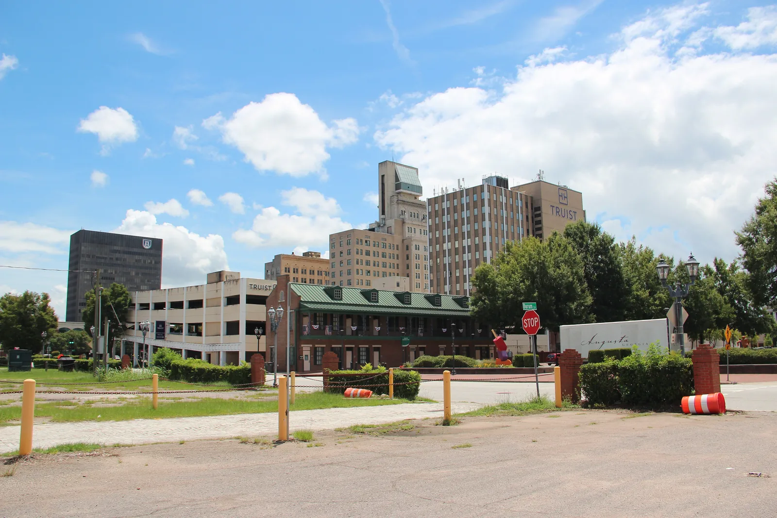
Nine Augusta neighborhoods from Downtown to Belair: ZIP codes, zoned high schools and August 2026 Zillow home values, with a map from city GIS data.
Last checked Oct. 6, 2026. Sources: Augusta’s GIS neighborhoods layer, historic district layers and municipal boundaries, the city’s 2023 comprehensive plan, the Richmond County School System’s School Zone and Bus Stop Locator, the state’s 2025 School Grades data, Zillow Research, the Census Bureau and OpenStreetMap.
Augusta is a city of 201,528 people, according to the Census Bureau’s 2020-2024 American Community Survey five-year estimates. It shares one consolidated government with Richmond County, so the city takes in almost the whole county; only Hephzibah, Blythe and Fort Eisenhower are separate, according to the city’s municipal boundaries map. The Savannah River and South Carolina form the eastern edge. Interstate 20 crosses the north side of the city, and Interstate 520, the Bobby Jones Expressway, curves around the west and south sides past Augusta Regional Airport and across the river. The Augusta Municipal Building, at 535 Telfair St., is downtown.
The city’s 2023 comprehensive plan divides the county into six character areas: Old Augusta, the pre-World War II city around downtown; West Augusta and Belair to the west; South Augusta; East Augusta along the river; and rural South Richmond. The city’s GIS neighborhoods map, which it labels unofficial, names 51 smaller areas. This guide covers nine of them.
Three things to know before you look at a listing:
- Mailing addresses cross county lines. ZIP codes 30907 and 30813 reach into Augusta, but Zillow labels them Martinez and Grovetown and lists both in Columbia County. Check the county on the parcel record before you count on Augusta services or Richmond County schools.
- One school district, many zone lines. The Richmond County School System serves the whole county, and its zone lines do not follow neighborhood lines. Summerville, Harrisburg, Belair and Forest Hills are each split between high school zones. Always check one address in the zone locator.
- Three local historic districts. Downtown, Olde Town and Summerville are local historic districts, where the Historic Preservation Commission reviews exterior changes. The plan describes design review only for those three local districts.
The areas at a glance
High school shares are of sample points checked in the district’s zone locator on Oct. 6. Home values are the Zillow Home Value Index for August 2026: a modeled typical value for the middle third of homes in the whole ZIP code, not a sale price. The citywide Augusta figure was $188,114.
| Area | Main ZIP code | Zoned high school | Typical value, main ZIP |
|---|---|---|---|
| Downtown | 30901 | Lucy C. Laney | $72,068 |
| Olde Town | 30901 | Lucy C. Laney | $72,068 |
| Laney Walker | 30901 | Lucy C. Laney | $72,068 |
| Bethlehem | 30901 | Lucy C. Laney | $72,068 |
| Harrisburg | 30904 | Laney (75%), Academy of Richmond County | $162,576 |
| Summerville | 30904 | Academy of Richmond County (60%), Westside | $162,576 |
| Sand Hills | 30904 and 30909 | Westside | $162,576 (30904) |
| Forest Hills | 30909 | Academy of Richmond County (95%) | $266,629 |
| Belair | 30909 | Westside (52%), Academy of Richmond County | $266,629 |
Map of the areas
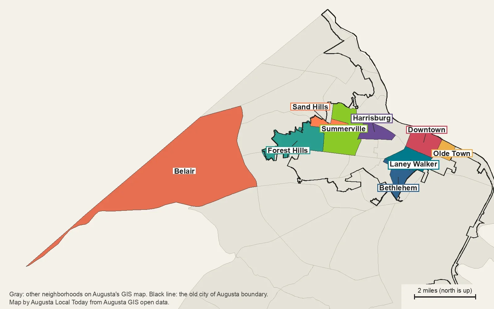
Map by Augusta Local Today from Augusta’s GIS neighborhoods layer and its old city of Augusta boundary layer. The gray areas are the city’s other mapped neighborhoods.
Downtown and the river
Downtown. The central business district on the Savannah River, with the Riverwalk, Augusta Common and the main library. Four Augusta Transit lines run through it.
Olde Town. A small local historic district of older houses just east of downtown, most of it inside the Pinched Gut Historic District.
South of downtown
Laney Walker. Older streets along Laney-Walker Boulevard, with Dyess Park, the Wallace Branch Library and the Augusta Canal’s restored third level.
Bethlehem. South of Laney Walker, two-thirds of it in a National Register district, with the city’s Bethlehem Community Center.
West of downtown
Harrisburg. Between Walton Way and the Augusta Canal, mostly in the Harrisburg-West End Historic District, split among three high school zones.
Summerville. The local historic district with the Partridge Inn and Augusta University, split between two high school zones.
Sand Hills. A small neighborhood west of Summerville with Big Oak Park, zoned for Westside High.
Forest Hills. Along Wrightsboro Road, with Forest Hills Golf Club and the Newman Tennis Center; annexed into the old city in the 20th century.
West Augusta suburbs
Belair. The suburban west side near Doctors Hospital and I-20 exits 194 and 195, about 12 square miles on the city’s map.
Not covered yet
The city’s map also names areas such as West Augusta, National Hills, Windsor Spring, Richmond Hill and East Augusta. They are not in this guide yet. Until they are, the zone locator, our home prices guide and our schools guide cover the whole city.
Comparing Augusta with its neighbors
Tax rates, schools, home values and commutes for Augusta, Grovetown, North Augusta and Martinez side by side: Augusta vs Grovetown vs North Augusta vs Martinez. Getting around the city: our getting around guide. The county and nearby towns: Augusta, Richmond County and the neighbors.
How we built this
We named only areas a public source places on a map. The sources were:
- Augusta’s GIS neighborhoods layer, published on the city’s open data site. The city labels it unofficial; every area in this guide is one of its 51 named neighborhoods, under the name it uses, except that we spell Forest Hills and Olde Town as the comprehensive plan and the city’s historic district maps do.
- The city’s 2023 comprehensive plan, which describes Downtown, Olde Town, Summerville, Laney Walker and the Belair character area, and the city’s historic district and National Register layers.
- OpenStreetMap place names, which match the city’s names for Forest Hills and Belair.
- School zones from the Richmond County School System’s own locator, checked at sample points across each area on Oct. 6, and ZIP codes from the city’s ZIP code layer.
We started with nine areas in and around the old city and on the west side; the rest of the city’s map is not covered yet. Neither the map nor the plan lists homeowners associations, so these pages do not either. Store and place data are © OpenStreetMap contributors. The district’s zone locator and the county’s parcel records are the authority for any one address.
Frequently asked questions
How many neighborhoods are in Augusta?
Augusta’s GIS neighborhoods map, which the city labels unofficial, names 51 areas across Richmond County. The city’s 2023 comprehensive plan groups the county into six larger character areas: Old Augusta, West Augusta, Belair, South Augusta, East Augusta and South Richmond. Our guide covers nine neighborhoods so far.
Is Augusta the same as Richmond County?
Almost. Augusta and Richmond County have one consolidated government, but Hephzibah, Blythe and Fort Eisenhower are separate, according to the city’s municipal boundaries map.
Do Augusta school zones follow neighborhood lines?
No. Summerville is split between the Academy of Richmond County and Westside High, Belair is split about evenly between the same two high schools, and Harrisburg is split among three. Check one address in the Richmond County School System’s zone locator.
Does an Augusta mailing address mean the property is in Richmond County?
Not always. ZIP codes 30907 and 30813 reach into Augusta, but Zillow labels them Martinez and Grovetown and lists both in Columbia County. Check the county on the parcel record before you count on Augusta services or Richmond County schools.
Have your say