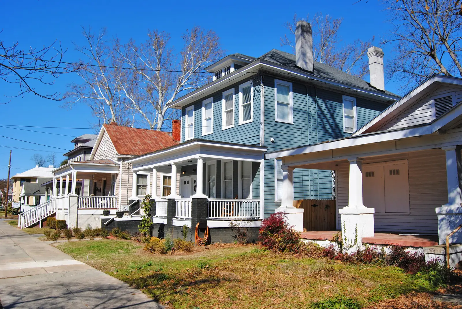
Olde Town is a local historic district east of downtown Augusta, zoned for Lucy C. Laney High. ZIP 30901's typical value was $72,068 in August 2026.
Last checked Oct. 6, 2026. Sources: Augusta’s GIS neighborhoods layer and historic district layers, the city’s 2023 comprehensive plan, the National Park Service’s National Register data, the Richmond County School System’s School Zone and Bus Stop Locator, the state’s 2025 School Grades data, Zillow Research, Augusta Transit’s route data and OpenStreetMap.
Olde Town is the small residential district just east of downtown Augusta. The city’s 2023 comprehensive plan says the Olde Town local historic district “was primarily single-family residences,” and that many houses remain single-family homes while others have become apartments or offices. The plan also places the Christ Community medical center and Augusta Heritage Academy, a private school at 333 Greene St., in the district. The city’s neighborhood map spells the area “Old Town” and draws it at about a third of a square mile.
What this means for you
- Zoned high school: Lucy C. Laney High, for the whole area. Check one address in the district’s zone locator.
- Home value: $72,068 in ZIP 30901 in August 2026, according to the Zillow Home Value Index.
- Nearest interstate exit: Interstate 520 exit 16 (Sand Bar Ferry Road and Laney-Walker Boulevard), about 4.4 miles by road.
- Historic district rules: exterior changes need approval first; see the city’s Olde Town design guidelines.
Part of our Augusta neighborhoods guide.
Where it is
Olde Town sits between downtown to the west and East Augusta to the east, with Broad, Greene and Telfair streets running through it. All of it is in ZIP code 30901. About two-thirds of the city’s mapped neighborhood is inside the Olde Town local historic district, which the city’s Historic Preservation Commission reviews, and about three-quarters is inside the Pinched Gut Historic District, listed on the National Register and described by the Park Service as roughly bounded by Gordon Highway, East Boundary, Reynolds Street and Gwinnett Street.
Schools
Olde Town is in the Richmond County School System. Every sample point across the area returned the same three schools in the district’s zone locator on Oct. 6; scores are 2025 College and Career Ready Performance Index (CCRPI) figures.
| Level | School | Share of area | 2025 CCRPI |
|---|---|---|---|
| High | Lucy C. Laney High, 1339 Laney Walker Blvd. (report card) | 100% | 59.9 |
| Middle | W.S. Hornsby Middle, 310 Kentucky Ave. (report card) | 100% | 65.4 |
| Elementary | W.S. Hornsby Elementary, 310 Kentucky Ave. (report card) | 100% | 66.2 |
Calendars, registration and the district’s magnet schools are in our schools guide.
Home values
The typical home value in ZIP 30901 was $72,068 in August 2026, up 8.70% from $66,300 in August 2025, according to the Zillow Home Value Index. The index is a modeled typical value for the middle third of homes, not a sale price, and 30901 also covers downtown, Laney Walker, Bethlehem and East Augusta. The citywide Augusta figure was $188,114, up 2.38% on the year. More in our home prices guide.
Parks and trails
- May Park, just southwest of Olde Town, with the May Park Community Center at 622 Fourth St., listed among the city’s park facilities.
- Edward M. McIntyre Sr. Riverwalk, a short walk west along the river, with access at 6th, 8th, 9th and 10th streets.
Augusta Fire Department Station 1 is inside the district at 1 Broad St. More places to walk and ride are in our parks and trails guide.
Getting around
- Augusta Transit: the Gold line (3, East Augusta) runs through Olde Town, according to the agency’s route data. Route cards are on the routes page.
- Interstates: I-520 exit 16 is about 4.4 miles by road and I-20 exit 200 (River Watch Parkway) about 7.4 miles, exits numbered as in OpenStreetMap.
- City hall and the airports: about 0.7 miles to the Augusta Municipal Building at 535 Telfair St., 11.1 miles to Augusta Regional Airport and 153 miles to Hartsfield-Jackson Atlanta International Airport. All are distances on the OpenStreetMap road network measured with the OSRM routing engine, not drive times.
Groceries and everyday stores
OpenStreetMap lists no supermarket or pharmacy inside Olde Town. The nearest supermarket it lists is Thriftee’s Supermarket on Sand Bar Ferry Road in East Augusta, about 0.9 miles by road.
HOAs
The city’s neighborhood map and comprehensive plan do not list homeowners associations, so this page does not either.
Who serves Olde Town
The Richmond County Sheriff’s Office patrols all of Augusta, the Augusta Fire Department answers fire calls, and Environmental Services runs trash pickup; see our trash and recycling guide. Tax rates are in our property tax guide. Compare Olde Town with other areas in our neighborhoods guide.
Frequently asked questions
Where is Olde Town in Augusta?
Just east of downtown Augusta, along Broad, Greene and Telfair streets. The city’s neighborhood map draws it at about a third of a square mile, all in ZIP code 30901.
What schools is Olde Town zoned for?
W.S. Hornsby Elementary, W.S. Hornsby Middle and Lucy C. Laney High, for the whole area, according to the Richmond County School System’s zone locator.
Is Olde Town a historic district?
Yes. Olde Town is one of Augusta’s three local historic districts, so exterior changes need a certificate of appropriateness from the Historic Preservation Commission. Most of it is also in the Pinched Gut Historic District on the National Register.
Is Olde Town a good place to live?
Here are the facts. Olde Town is a small district of older houses next to downtown, zoned for Lucy C. Laney High, which scored 59.9 on the state’s 2025 CCRPI. The typical home value in ZIP 30901 was $72,068 in August 2026, according to Zillow.
Have your say